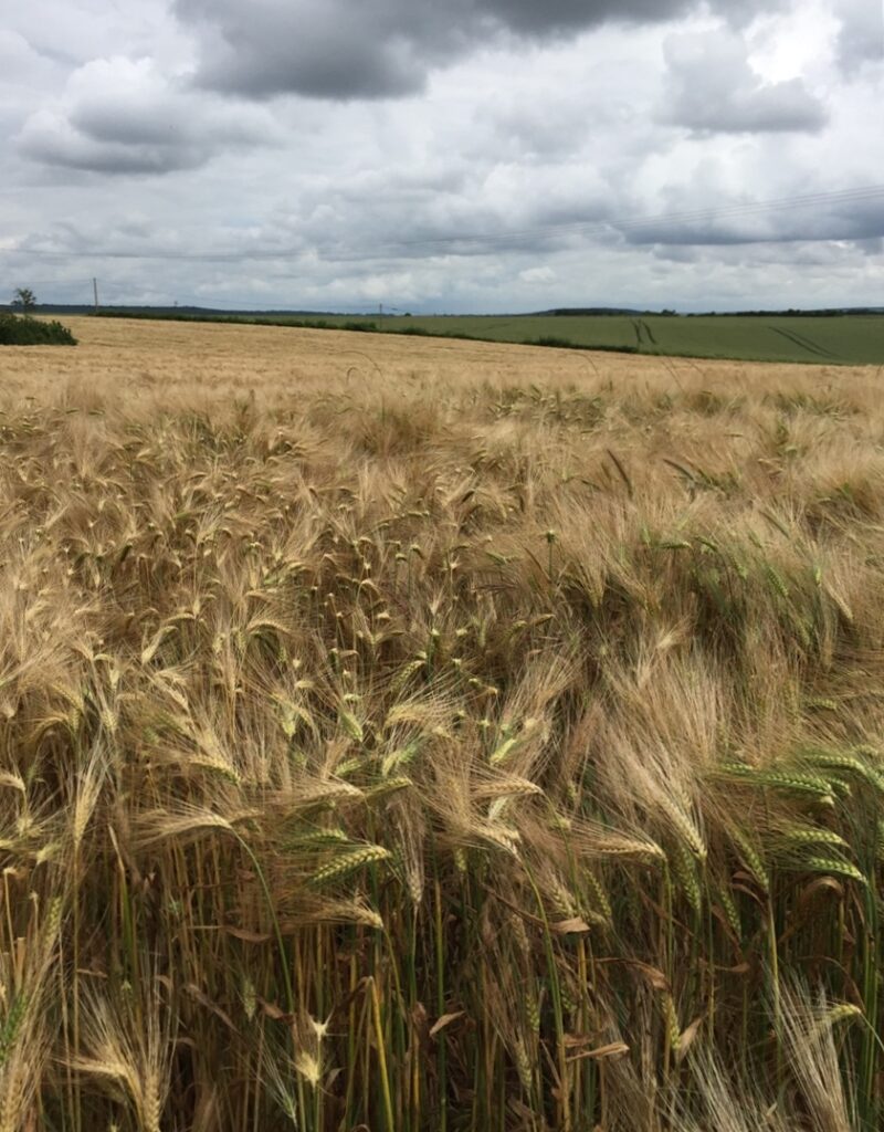
 Poitou – the grain bowl of Europe (Author photo) In Double Identity, Mel’s surname – des Pittones – is based on the Pictones, a Celtic tribe in ancient Gaul, a tribe that gave its name to Poitou in western France. And her family has been settled in the area for hundreds and hundreds of years.
So it was extremely tempting to make her surname (as translated into English) ‘Melisende of the Pictones’. Oh, the fun of being the mistress of one’s book universe!
So, Poitou, Mel’s home…
Poitou is much mentioned in medieval literature, history and historical fiction but it was a royal kingdom a thousand years before Eleanor of Aquitaine’s time!
Yes, it’s Celts and Romans again…
The Gauls were a group of Celtic peoples of Continental Europe in the Iron Age and the Roman period (roughly from the 5th century BCE to the 5th century CE). Finally conquered by Julius Caesar in the 50s BCE, the Gauls became more or less assimilated into Gallo-Roman culture.
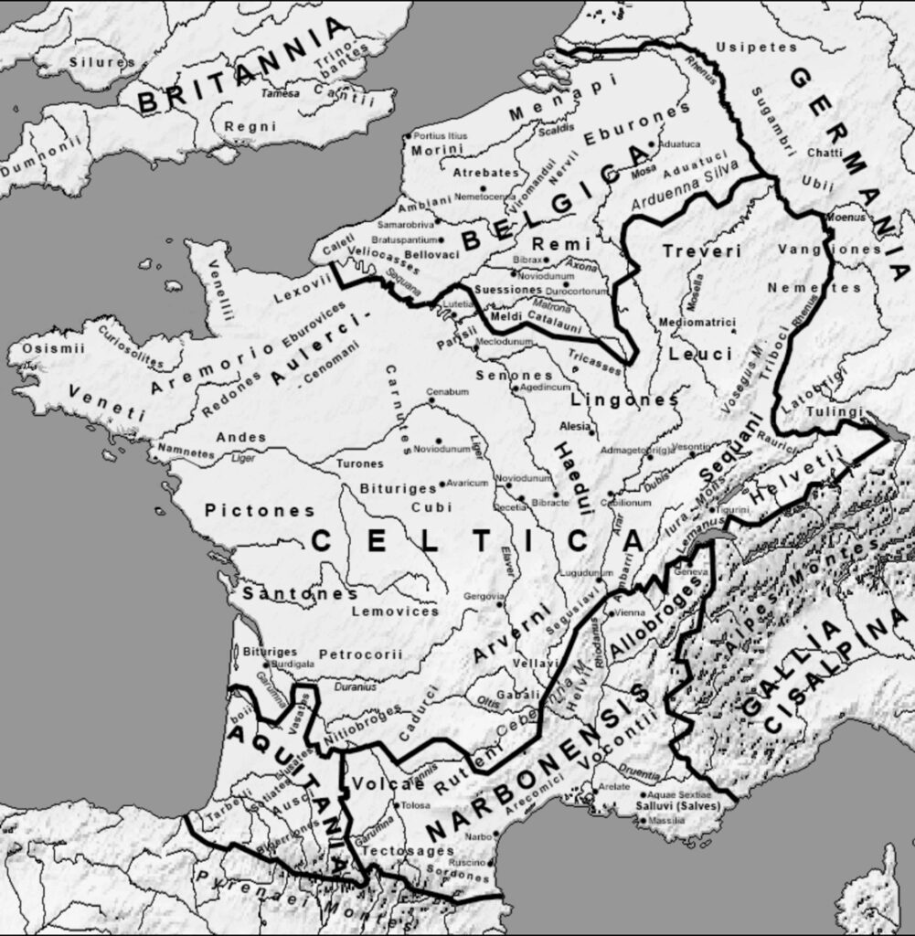 Caesar mentions the inhabitants of the central western part of Gaul/France as ‘Pictones’. Pliny (1st century CE) called them ‘Píktones’ and Ptolemy (2nd century CE) and Ausonius (4th century CE) called them ‘Pictonici’. They are also known as ‘Pictavi’ from the 2nd c. CE, in the Notitia Galliarum and in Ammianus Marcellinus’s Res Gestae (4th century CE). Caesar mentions the inhabitants of the central western part of Gaul/France as ‘Pictones’. Pliny (1st century CE) called them ‘Píktones’ and Ptolemy (2nd century CE) and Ausonius (4th century CE) called them ‘Pictonici’. They are also known as ‘Pictavi’ from the 2nd c. CE, in the Notitia Galliarum and in Ammianus Marcellinus’s Res Gestae (4th century CE).
The city of Poitiers, recorded as ‘urbis Pictavorum’ ca. 356 CE, ‘Pictavis’ in 400–410, ‘Peitieus’ or ‘Pectievs’ in 1071–1127, and the region of Poitou are named after the Gallic tribe.
What else do we know about the Pictones?
They minted coins from the end of the 2nd century BCE and like many Celtic tribes practised organised farming, skilled technology and produced high quality artistry. They traded withe the rest of Gaul, sometimes further afield, and with the British Isles from the harbour of Ratiatum (Rezé), which served as an important port linking Gaul and Roman Britain. The region was known for its timber resources and Caesar depended on their shipbuilding skills for his fleet on the Loire.
Politically, the region was governed by the royal Celtic system. Duratios was king of the Pictones during the Roman conquest, but his power waned thanks to the poor skill of and strong rivalry between his warrior chiefs. However, the Pictones frequently aided Julius Caesar in naval battles, particularly with the naval victory over the Veneti on the Armorican peninsula.
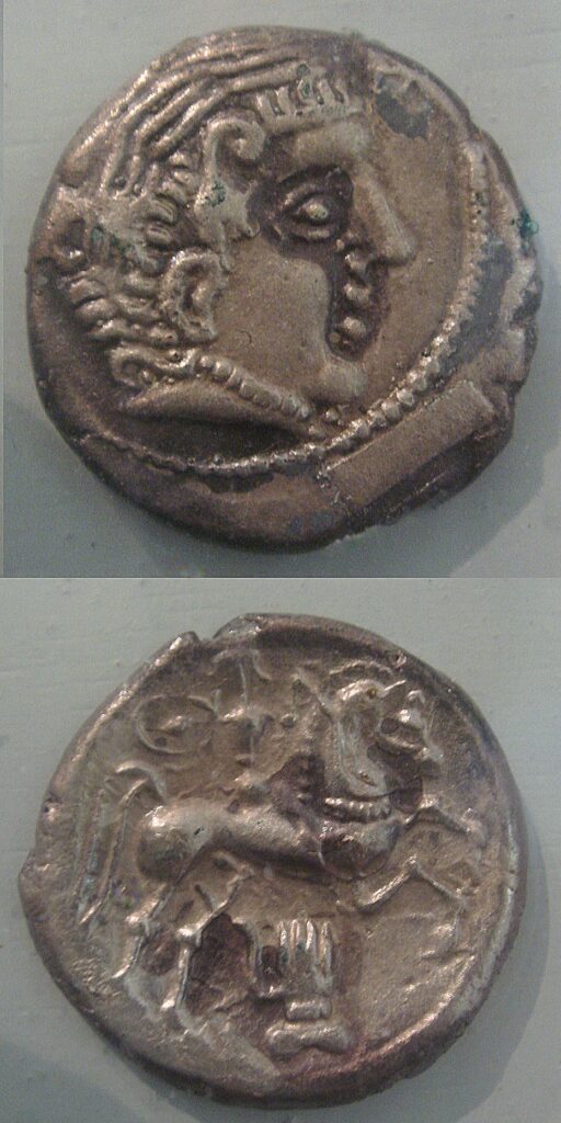 Pictones coinage ca.1st century BCE Collaboration or survival strategy?
The Pictones had felt threatened by the migration of the Helvetians toward the territory of the Santones to their south and supported the intervention by Caesar in 58 BCE. Though fiercely independent, they collaborated with Caesar, who noted them as one of the more ‘civilised’ tribes. Nevertheless, 8,000 Pictones went to aid Vercingetorix, the chieftain who led the Gaulish rebellion in 52 BC. This understandably divided the Pictones and the region suffered various uprisings, especially around Lemonum (Roman name for Poitiers). This was later quelled by legate Gaius Caninius Rebilus and finally by Caesar himself.
The Pictones benefited from Roman peace, notably through many urban constructions such as aqueducts and temples. However, apart from the elite classes who even sent the odd senator to Rome itself, they were not Romanised in depth.
What was Pictones home territory?
From place names, coin finds and early church records, it would seem that territory of the Pictones before the Roman conquest stretched over the current départements of Vienne and Deux-Sèvres, i.e. Haut-Poitou and possibly the southern part of the Vendée. The rest of the Vendée was very probably territory of the Ambilatres. Early suggestions that their territory reached as far as the south bank of the Loire along its entire western course before the Roman conquest have been largely abandoned. However, after the conquest, the territories occupied by today’s three départements formed a single unit which lasted until the French Revolution, i.e. more than eighteen centuries.
A strategic place
Poitou, a rich and fertile farming region, although sure of its identity is an area of transition: the langue d’oc meets the langue d’oïl, slate roofs meet Roman tile roofs, the north meets the south. The Poitou Gap (Seuil du Poitou) is where the Paris (north east) and Aquitaine (south west) sedimentary basins meet and the ancient mountain ranges Massif Armoricain (north west) and the Massif Central (south east) separate.
Because it’s a strategic access between the north and south of France, the area in and around the Seuil du Poitou has been the site of many battles and disputes, not least between the English and French.
- Battle of Vouillé (507) victory by the Franks led by Clovis against the Visigoths
- Battle of Poitiers (732), victory by the Franks led by Charles Martel against the Moors
- Battle of Poitiers (1356), which actually took place at Nouaillé-Maupertuis, victory by the English led by the Black Prince against the French led by Jean II who was taken prisoner
- Battle of Moncontour (1569) defeat of the Protestants led by Admiral de Coligny by the royal army commanded by the Duke of Anjou.
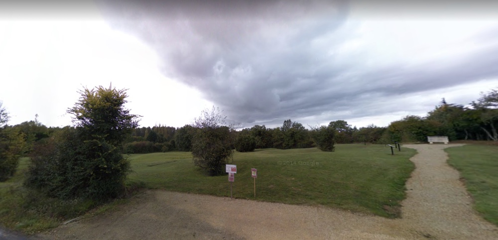 Nouaillé-Maupertuis (Battle of Poitiers 1356) today Forward in time
After Roman rule disappeared, several peoples migrated to, and settled in, Poitou: Taïfales, Angles, Sarmates; it was, however, the Visigoths who united it with their kingdom of Aquitaine in the 4th century until the battle of Vouillé (see above).
In 778, Charlemagne instituted the county of Poitiers with its first count, Abbon. They went on to establish a principality from the 9th century which extended between the Loire and Pyrenees, under the name of Aquitaine.
At the beginning of the eleventh century, the Count of Anjou, Foulque Nerra, waged unrelenting wars against the counts of Blois, Brittany and Poitiers. Many times victorious over his adversaries, he enlarged Anjou by conquering Maine, Touraine and seized the Mauges. Once again Poitou lost territory.
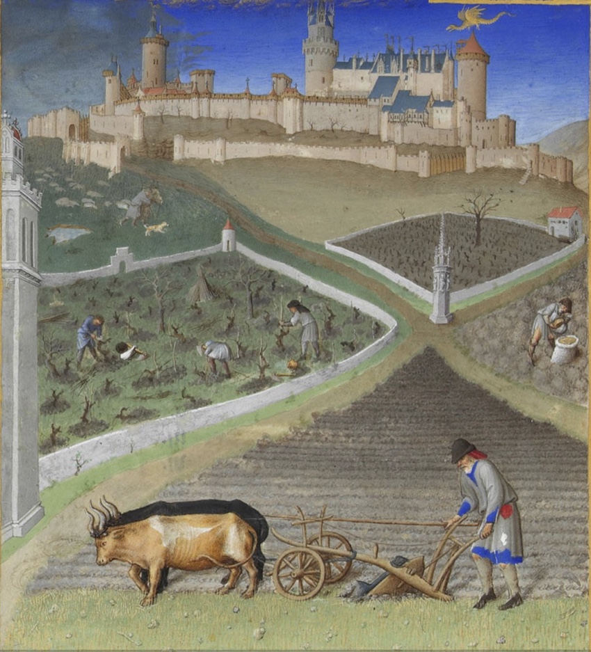 Château de Lusignan, Les Très Riches Heures du duc de Berry Despite various dynastic marriages including that of Eleanor of Aquitaine with King Louis VII of France, her annulment and remarriage with Henri II of England, Poitou was determined to retain some autonomy. Poitevins/Poitevines are an independent lot! The Poitou nobility demonstrated this through numerous revolts: first against the King of England in 1173-1179, 1188 and 1194; then in 1219-1224 and 1242 against the King of France. Right up to the end of the Middle Ages, the Poitou nobility was active in all protest and rebellion against the central power of the king.
Just as a side note, one of those ‘local’ families was the house of Lusignan, founded according to legend by Mélusine and Raymondin, and which provided several kings of Cyprus and Jerusalem.
Religions at war
In the sixteenth century, the Reformation in the shape of the teachings of Calvin took hold in Poitou particularly in the countryside. Poitou was strongly pro-Protestant (Huguenot) during the wars of religion (1562–1598) and suffered badly (sieges of Niort, Poitiers). Under the Edict of Nantes, discrimination against Huguenots was temporarily suspended but this measure was repealed by the French crown.
Unsurprisingly, as a consequence, significant numbers of Poitevins emigrated to New France in Quebec. I saw many surnames common in my area of the Deux-Sèvres peppered throughout Quebec and Montreal during my trip there in 2015. A little spooky, but a vivid reminder of real events in the past.
Après la révolution
In 1790, when France was reorganised administratively during the French Revolution, Poitou was divided up into the départements of Vendée, Deux-Sèvres and Vienne, although some former Poitou parishes were integrated into new communes of neighbouring départements.
But if you ask my neighbours in 2020 what part of France they come from and quote their département at them, most say almost with indecent haste, “Mais je suis poitevin!”
And my new heroine, Mel, for all her sophisticated Paris schooling and service abroad in the French Army, is very much a daughter of her region.
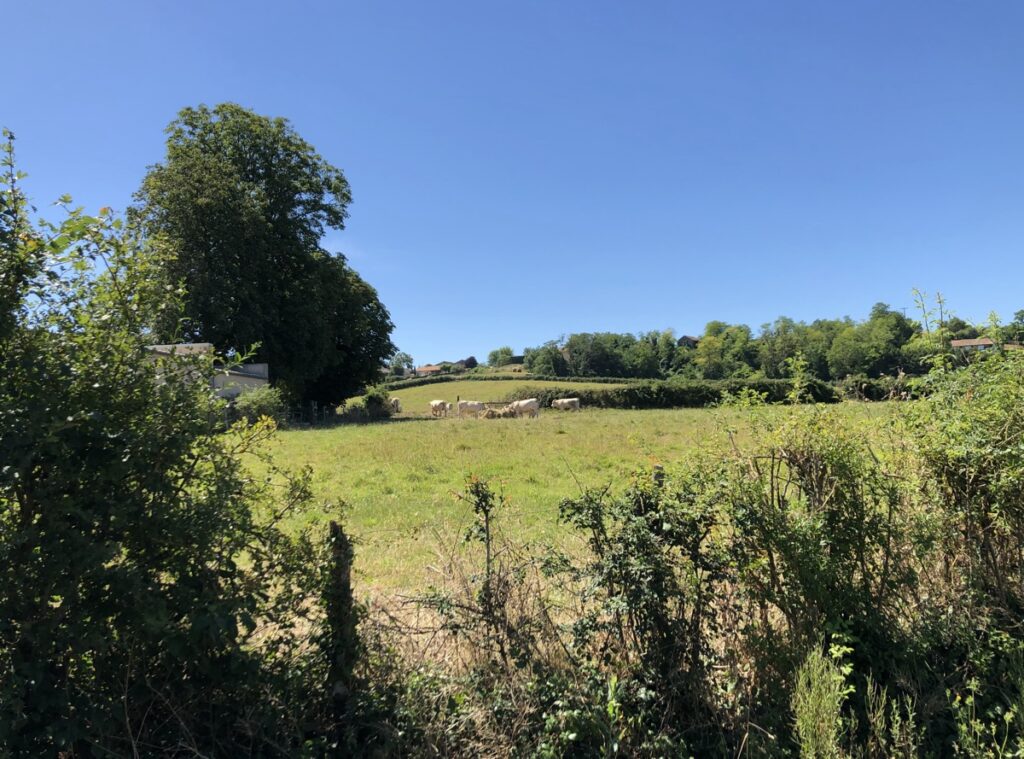 A Poitou farm today (Author photo)
Alison Morton is the author of Roma Nova thrillers – INCEPTIO, CARINA (novella), PERFIDITAS, SUCCESSIO, AURELIA, NEXUS (novella), INSURRECTIO and RETALIO, and ROMA NOVA EXTRA, a collection of short stories. Audiobooks are available for four of the series. Double Identity, a contemporary conspiracy, starts a new series of thrillers. Double Pursuit, the sequel, is now out!
Download ‘Welcome to Alison Morton’s Thriller Worlds’, a FREE eBook, as a thank you gift when you sign up to Alison’s monthly email newsletter. You’ll also be among the first to know about news and book progress before everybody else, and take part in giveaways.
If you enjoyed this post, do share it with your friends!
 Double Identity starts a new thriller series featuring Mel, and McCracken, but who are they? Double Identity starts a new thriller series featuring Mel, and McCracken, but who are they?
Mélisende des Pittones, known as Mel, 29, daughter of a French father and English mother, just left her French Army job as an intelligence analyst in a special forces team. She’s tall, athletic build, dark blonde shoulder length hair, worn up in formal situations; brown eyes.
She’s well educated and from a privileged background and chose to enter the French army at 18 rather than pursue her studies. She’s been on some gritty and extremely dangerous missions in French-speaking parts of the world, but tends to keep it all shut away in a different part of her mind.
At the start of Double Identity, she’s engaged to marry Gérard Rohlbert, who has been working in the City of London. But sadly, Mel’s future life with her perfect partner, living a Parisian metropolitan lifestyle, possibly with children, is wrecked on page 1.
Jeff McCracken, detective heading the police investigation, 37, an inch or two taller than Mel; well built without being overweight; dark brown hair in a conservative/classic style; grey eyes. Cynical and intelligent, he’s an ex-council estate boy who’s shucked off the petty criminal environment of his youth and worked tenaciously to achieve a solid reputation for success.
He appears to be no respecter of persons – he doesn’t rate posh birds like Mélisende – but he’s not quite the rough diamond he likes to project…
 How can they work together, even when compelled to? How can they work together, even when compelled to?
Both Mel and McCracken are intelligent, competent and persistent; his problem is his mouth, hers is attitude, coupled with a secret dread of failure.
He mistrusts her methods and must learn to appreciate and respect a colleague with different expertise and professional background.
She must acknowledge that not everybody is honest, even her adored, now dead, fiancé, or as stubborn and insensitive as McCracken appears to be.
Whether they survive working together when forced to, let alone liking each other, is anybody’s guess.
———–
Double Identity is now out in paperback and ebook.
Ebook: Amazon Apple Kobo B&N Nook
Paperback: Amazon worldwide Barnes & Noble Book Depository or other sites where you order paperbacks
———–
Alison Morton is the author of Roma Nova thrillers – INCEPTIO, CARINA (novella), PERFIDITAS, SUCCESSIO, AURELIA, NEXUS (novella), INSURRECTIO and RETALIO, and ROMA NOVA EXTRA, a collection of short stories. Audiobooks are available for four of the series.
Download ‘Welcome to Alison Morton’s Thriller Worlds’, a FREE eBook, as a thank you gift when you sign up to Alison’s monthly email newsletter. You’ll also be among the first to know about news and book progress before everybody else, and take part in giveaways.
If you enjoyed this post, do share it with your friends!
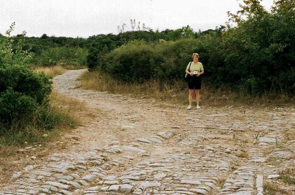 I do love a good Roman road. I do love a good Roman road.
In ‘The Idealist’ my contribution to the recent Betrayal anthology, Statia Mitela could not have fulfilled her mission in 1849 Rome without these roads built by her ancestors and which have endured as routes and often the only properly paved road in the area through the millennia.
You can find Roman roads (viae Romanae), whether almost fully intact or reduced to little more than a trackway, all over Europe, even in the barbarous little island to the north called Britannia. The one in the photo is the Via Domitia at Ambrussum, near Nimes in southern France which provided a fast and sure link from Spain to Italy and northwards up the Rhone valley. It was built in 118 BC by the proconsul Gnaeus Domitius Ahenobarbus and is still with us, wheel ruts and all, over 2,000 years later.
If you asked people what defined Roman engineering, Roman roads would lie towards the top of the list. They were the physical infrastructure vital to the maintenance and development of the Roman state and were built from about 300 BC through the expansion and consolidation of the Roman Republic and the Roman Empire.
Primarily, the roads were for military use as a quick and efficient means for overland movement of armies and officials However, they also allowed the movement of people and goods, and connected isolated communities, helping them to absorb new ideas and influences, sell surplus goods, and buy what they could not produce locally. This trade resulted in an increase of wealth for everyone to a level not seen before and is suggested as a strong reason why many people strove to adopt the lifestyle of their conquerors.
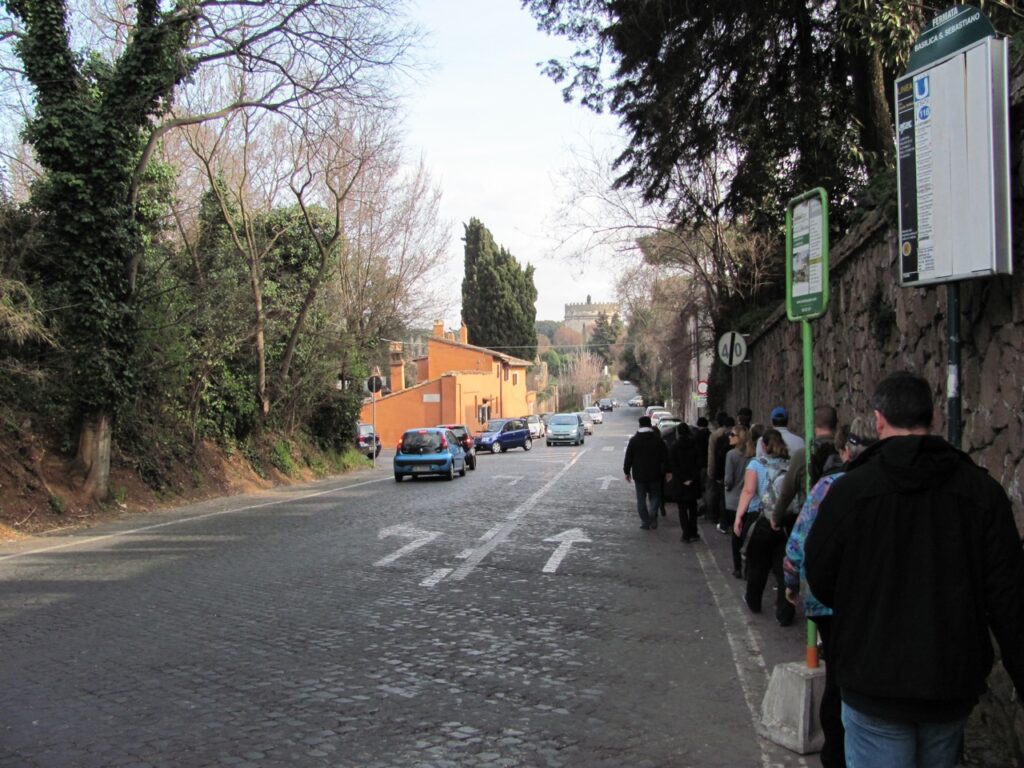 Via Appia, Rome today (Author photo) These Roman roads ranged from small local roads to broad, long-distance highways built to connect cities, major towns and military bases. These major roads were often stone-paved and metalled, cambered for drainage, and flanked by footpaths, bridleways and drainage ditches. They were laid along accurately surveyed courses and some cut through hills or over rivers and ravines on complex bridgework. Sections could be supported over marshy ground on rafted or piled foundations.
 Roman surveyor with groma (left) and dioptra (right) at the Eboracum Roman Festival 2019 (Author photo) The Roman surveyors (agrimensores) were highly skilled professionals, able to use a number of tools, instruments, and techniques to plan the courses for roads and aqueducts, and lay the groundwork for towns, forts and large buildings. We half-jokingly talk about the Romans and their straight roads, but that throwaway statement is not far away from the truth. Much more about surveyors, techniques and instruments at https://explorable.com/roman-roads.
Some numbers
At the peak of Rome’s development, no fewer than 29 great military highways radiated from the capital, and the late Empire’s 113 provinces were interconnected by 372 great roads. The whole comprised more than 400,000 kilometres (250,000 miles) of roads, of which over 80,500 km (50,000 mi) were stone-paved. In Gaul alone, no less than 21,000 km (13,000 mi) of roadways are said to have been improved, and in Britain at least 4,000 km (2,500 mi). The courses (and sometimes the surfaces) of many Roman roads survived for millennia; quite a number have been overlaid by modern roads.
So were all roads like the ones in the movies?
No. Like ours today, they had different uses and were built to different specifications.
Viae publicae, consulares, praetoriae and militares
The first type of road included public main roads, constructed and maintained at the public expense; the state owned the land they were built on. Such roads led either to the sea, or to a town or to another public road.
Roman roads were often named after the censor who ordered their construction or reconstruction. That same person often served afterwards as consul, but the road name is dated to his term as censor. If the road was older than the office of censor or was of unknown origin, it took the name of its destination or of the region through which it mainly passed. A road was renamed if the censor ordered major work on it, such as paving, repaving, or rerouting.
Viae privatae, rusticae, glareae and agraria
The second category included private or country roads, originally constructed by private individuals, who owned the land they were built on and who had the power to dedicate them to the public use. Such roads benefited from a right of way, in favour either of the public or of the owner of a particular estate. Viae privatae were also included roads leading from the public or high roads to particular estates or settlements.
Roads off the main via were connected by viae rusticae, or secondary roads. Both main or secondary roads might either be paved, or left unpaved, with a gravel surface, as they were in North Africa. These prepared but unpaved roads were viae glareae or sternendae (“to be strewn”). Beyond the secondary roads were the viae terrenae, “dirt roads”.
Viae vicinales
The third category comprised roads at or in villages, districts, or crossroads, leading through or towards a vicus or village. Such roads ran either into a main road or into other viae vicinales without any direct communication with a high road. They were considered public or private, according to whether they were funded by public or private funds or materials. Even if privately constructed, this type of road became a public road when the memory of its private constructors had perished.
The repairing authorities in this case were the magistri pagorum or magistrates of the cantons. They could ‘require’ the neighbouring landowners either to provide labourers for the general repair of the viae vicinales or to keep in repair, at their own expense, a certain length of road passing through their respective properties. It was probably in their own interest anyway as without a good road farm produce couldn’t get to market.
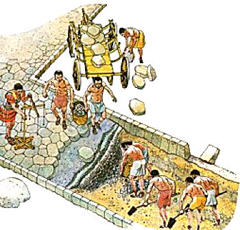
Building the roads
We have the funding and the responsibility, but who actually did the heavy lifting in the first place?
Building the main viae was a military responsibility and thus came under the jurisdiction of a consul. The process had a military name, viam munire, as though the via were a fortification. Municipalities, however, were responsible for their own local roads (viae vicinales).
The beauty and grandeur of the big roads might tempt us to believe that any Roman citizen could use them for free, but charging for using roads is not a new idea. Tolls abounded, especially at bridges. Often they were also collected at the city gate. Freight costs were made heavier still by import and export taxes, often between provinces. On Apulius’s journey to Virunum in The Girl from the Market, a customs official tries to extract duties as Apulius crosses from Raetia into Noricum on his way to his posting in Virunum.You can imagine the answer Apulius, as a serving military tribune, gave him…
These were only the charges for using the roads. Costs of services for the journey, e.g. horse, mule and carriage hire or haulage charges for goods was on top.
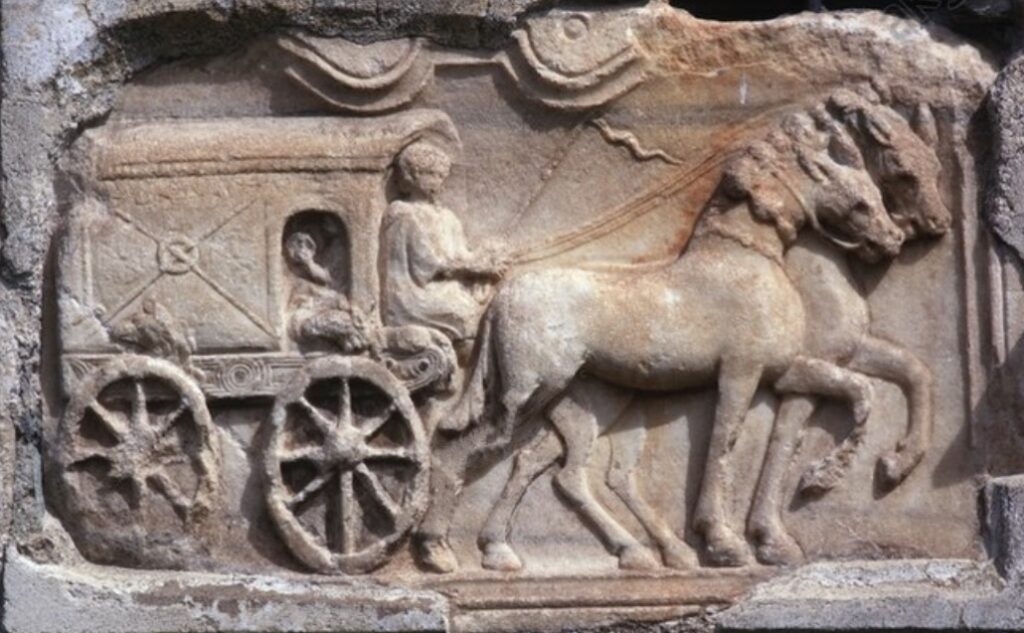 Roman relief depicting a travelling wagon (raeda)from a tomb from Virunum, Zollfeld, Austria. Along comes Augustus who tended to change everything…
In his overhaul of the urban administration, Augustus both abolished and created new offices for the maintenance of public works, streets and aqueducts in and around Rome. And, of course, he had Agrippa to supervise them with an unrivalled, almost frightening, efficiency. Emperors succeeding Augustus exercised vigilant control over the condition of public highways and their names occur frequently in the inscriptions to restorers of roads and bridges.
Down to the nitty-gritty
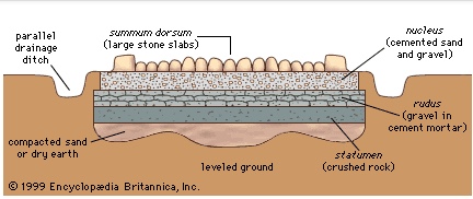
Roman road builders aimed at a regulation width, but actual widths have been measured at between 1.1 m (3.6ft) and more than 7 m (23ft) Today, the concrete has worn from the spaces around the stones, giving the impression of a very bumpy road, but the original practice was to produce a surface that was no doubt much closer to being flat. Many roads were built to resist rain, freezing and flooding and to need as little repair as possible. (Lessons for us today?)
Roman construction took a directional straightness(!). Many long sections are ruler-straight, but not all of them were. Some links in the network were as long as 89 km (55 mi). Gradients of 10%–12% are known in ordinary terrain, 15%–20% in mountainous country. The Roman emphasis on constructing straight roads often resulted in steep slopes relatively impractical for most commercial traffic; over the years the Romans themselves realised this and built longer, but more manageable, alternatives to existing roads. Roman roads generally went straight up and down hills, rather than in a serpentine pattern of switchbacks.
Materials and methods
Viae were distinguished not only according to their public or private character, but according to the materials employed and the methods followed in their construction.
- Via terrena: A plain road of levelled earth.
- Via glareata: An earthed road with a gravelled surface or or a gravel subsurface and paving on top.
- Via munita: A standard built road, paved with rectangular blocks of the stone of the country, or with polygonal blocks of lava.
The Romans, though certainly inheriting some of the art of road construction from the Etruscans, were said to have borrowed the knowledge of construction of viae munitae from the Carthaginians.
How far from A to B?
Milestones divided the via Appia even before 250 BC into numbered miles, and most viae after 124 BC. A milestone, or miliarium, was a circular column on a solid rectangular base, set for more than 2 ft/0.61m into the ground, standing 5ft/1.5m tall, 20in/51cm in diameter, and weighing more than 2 tons. At the base was inscribed the number of the mile relative to the road it was on.The milestone below dates from the time of Antoninus Pius (138-161 AD).
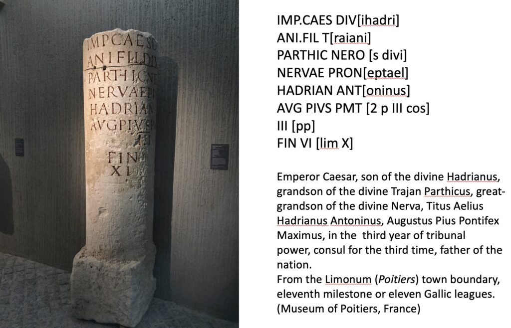 Roman milestone, Poitiers Museum (Author photo and translation) When Augustus, after becoming permanent commissioner of roads in 20 BC, set up the miliarium aureum (“golden milestone”) near the Temple of Saturn a panel at eye-height on milestones showed the distance to the Roman Forum as well as various other details about the officials who made or repaired the road. All roads were considered to begin from this gilded bronze monument. On it were listed all the major cities in the empire and distances to them.
And as we know, all roads lead to Rome.
Alison Morton is the author of Roma Nova thrillers – INCEPTIO, CARINA (novella), PERFIDITAS, SUCCESSIO, AURELIA, NEXUS (novella), INSURRECTIO and RETALIO, and ROMA NOVA EXTRA, a collection of short stories. Audiobooks are available for four of the series.
Download ‘Welcome to Alison Morton’s Thriller Worlds’, a FREE eBook, as a thank you gift when you sign up to Alison’s monthly email newsletter. You’ll also be among the first to know about news and book progress before everybody else, and take part in giveaways.
If you enjoyed this post, do share it with your friends!
|
Subscribe to Blog via Email
Join 37 other subscribers.
Buy AURELIA from Apple!
UK

US
|