The old clichéd saying that ‘Rome wasn’t built in a day’ is true, but so was its ‘decline and fall’ equally slow. Going from its traditionally accepted date of foundation the Roman Empire in the West of 753 BC, it lasted 1229 years in the West until the abdication of Romulus Augustulus in 476 AD.
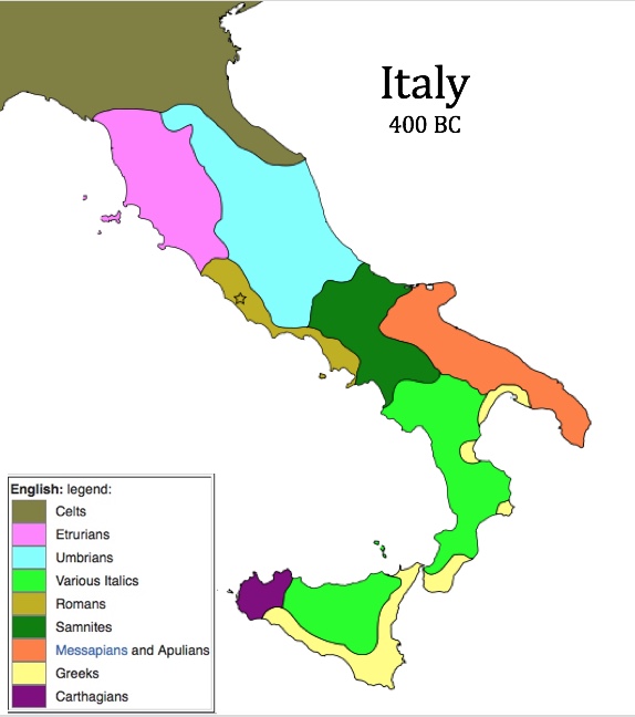
Maps can show us the passing of that time from the period when Rome was a scruffy village, then under Etruscan influence, then starting to break out in Italy by 400 BC. But it was still not a power in any sense; its neighbours were bigger and better established.
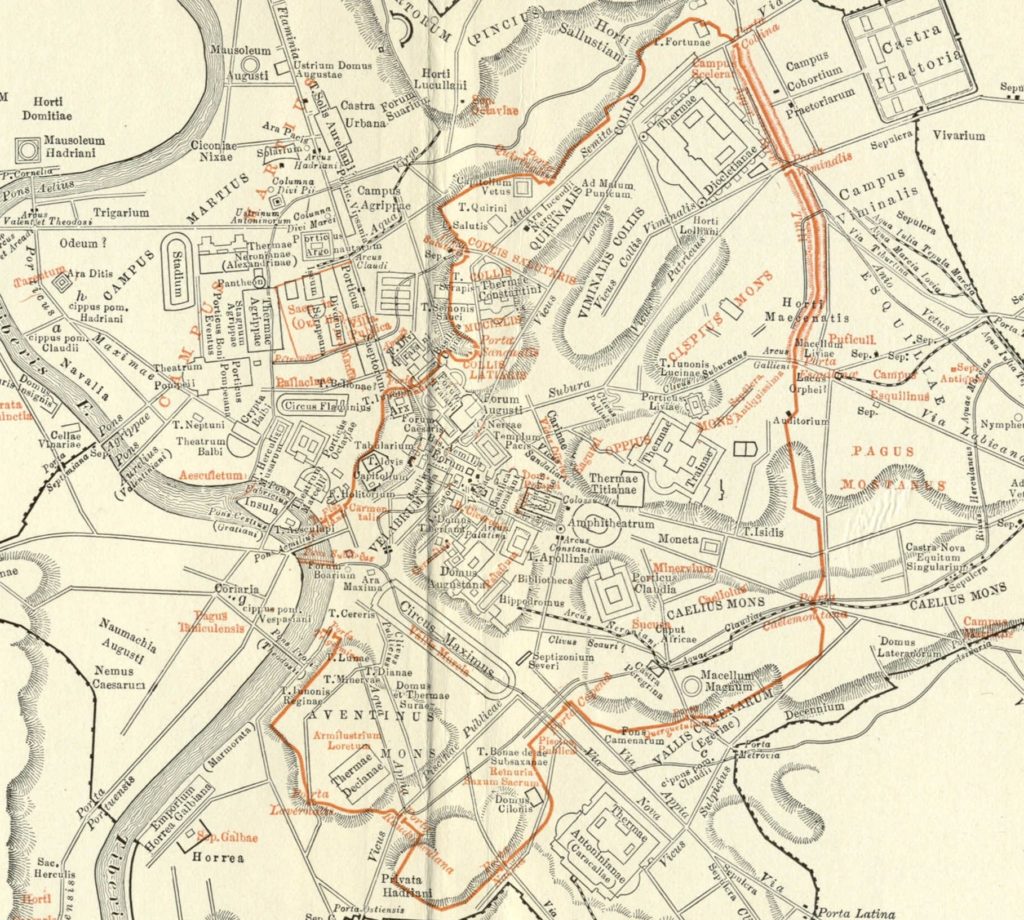
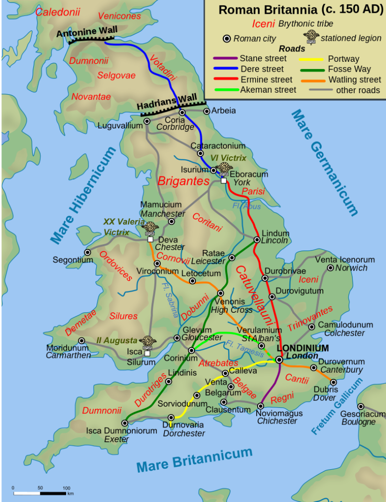
Maps also show the complexity of the Roman Empire. Rome eventually grew to a city with a population of over 1 million, something not seen again until the 19th century when the Victorians ‘invented’ (read re-discovered) many aspects of life similar to that of the Ancient Romans, whether taps, cement or legal process. Anyway, back to Rome… The sheer number and complexity of public buildings is impressive as shown by this plan of Imperial Rome drawn up by Samual Platner in his 1904 study (Places and buildings in red date from the Republic):Wherever Rome went, they built roads. We know that good infrastructure facilitates movement of people and goods, often resulting in increased trade, prosperity and life chances, but the Romans built them to move the military around quickly; everything else was a bonus. In an offshore island full of stroppy Britons, fast transport of troops was a strategic and tactical necessity.
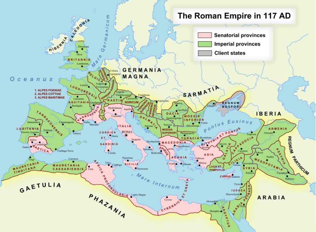
Trajan (b. 53 AD, reigned 98 – 117 AD) was the soldier-emperor who presided over the greatest military expansion in Roman history; the empire reached its maximum territorial extent by the time of his death. He was also known for his philanthropic rule, extensive public building programs and implementing social welfare policies, which earned him a reputation as the second of the ‘Five Good Emperors’. The Romans had ‘never had it so good’, to misquote 1950s British prime minister Harold Macmillan.
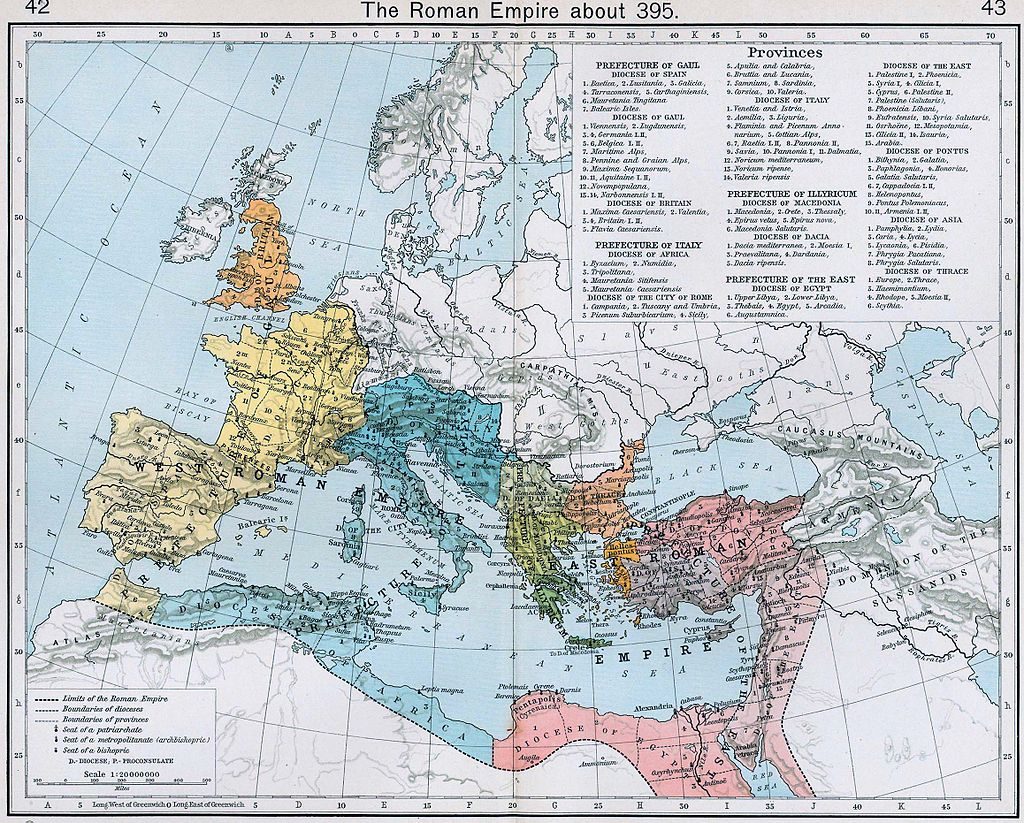
By the time the imaginary Roma Novans left the city of Rome, the Empire had split, re-formed, was on the point of definitively splitting into east and west, and was Christianised.
Over eighty years later, a year after the last western emperor abdicated, only rump states remained in the west.
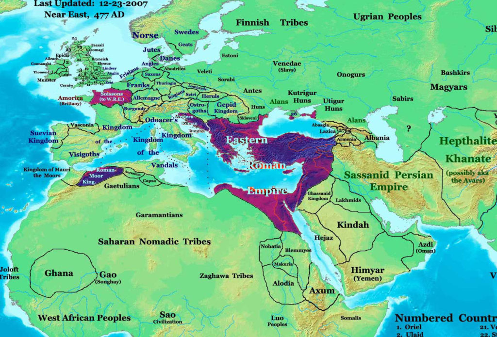
Europe in 477 AD. Highlighted areas are Roman lands that survived the deposition of Romulus Augustulus. (Thomas Lessman CC BY-SA 3.0)
Alison Morton is the author of Roma Nova thrillers INCEPTIO, PERFIDITAS, SUCCESSIO, AURELIA and INSURRECTIO. The sixth, RETALIO, came out in April 2017. Audiobooks now available for the first four of the series
Get INCEPTIO, the series starter, for FREE when you sign up to Alison’s free monthly email newsletter. You’ll also be first to know about Roma Nova news and book progress before everybody else, and take part in giveaways.




Very fascinating, especially since I recently learned about this period in history class. I’m looking forward to your account of how Roma Nova was formed.
Hi Juliet. Thanks for stopping by.
You can read how Roma Nova came about here: http://www.alison-morton.com/roma-nova/roma-nova-history/
Excellent article. I’m a huge fan of ancient Italian/Roman history. I especially am drawn to the Etruscans and the Samnites. I have your Roma Nova books on my “to-read” list. Best wishes!
Thank you, Pamela. I love maps! Just the placement of buildings, roads, walls on the physical landscape can tell you so much. And I hope you enjoy the Roma Nova books. Happy reading!